
| Site Map
Toolkit > Mapping Resources - Building Your Community Resource Inventory (CRI)
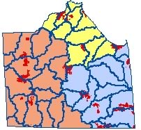
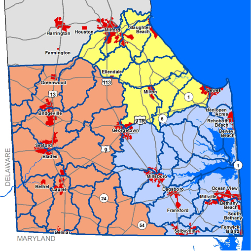
Step 1. Choose a subwatershed by clicking on the Sussex County map to the left or by using the pull down menu below.
Step 2. Click on one of the three "Resource" tabs to view data within your chosen watershed.
Step 3. Click on the "Print Your Atlas" button to print out a (pdf) version of your chosen watershed.
NATURAL RESOURCES |
CULTURAL RESOURCES |
ECONOMIC RESOURCES |
- Base Map
- Hydrology
- 2007 Aerials
- 2007 Land Use
- Outdoor Recreation Inventory
- Wetlands
- Elevation
- Agricultural Lands
- Groundwater Recharge
- Floodplains
- Impervious Surfaces
- Tax Ditches
- State Investment Strategies
- EPA Impaired Waters
- Sussex County Zoning
- PLUS Projects
- Parcel Boundaries
- Historical Sites and Districts
- Communities
- School Locations and Districts
 |